Uttam Nagar is one of the rare Delhi localities that gets two dedicated metro stations of its own — East and West — a reflection of just how large and densely populated this West Delhi suburb has become. With over 1.8 lakh residents packed into a network of sub-towns, it’s grown into one of the city’s most rapidly urbanising pockets since the metro first arrived here. Here’s a complete breakdown of where it sits, its pin code, transport options, and what surrounds it.
Uttam Nagar Quick Overview
| Detail | Information |
| Locality | Uttam Nagar |
| City | Delhi |
| District | West Delhi |
| Pin Code | 110059 |
| Population (approx.) | 1,82,171 |
| Assembly Constituency | Uttam Nagar |
| Parliamentary Constituency | West Delhi |
| Nearest Metro Stations | Uttam Nagar East, Uttam Nagar West (Blue Line) |
| Major Roads | Najafgarh Road, NH-44 |
| Bordering Localities | Dwarka Mor, Nawada, Vikaspuri, Hastsal, Vijay Vihar |
Location and Character
Uttam Nagar sits in West Delhi, made up of several sub-towns that have urbanised rapidly since the Blue Line metro arrived in the mid-2000s. The locality’s proximity to key transportation hubs — the metro, the airport, and Gurugram — has made it an increasingly attractive residential option, particularly for people who want reasonably affordable housing without giving up connectivity to major employment centres. That same rapid growth has brought predictable challenges too: congestion and infrastructure strain that residents regularly flag, a byproduct of population growth outpacing civic upgrades in parts of the locality.
Pin Code Details
Uttam Nagar’s pin code is 110059, covering a genuinely large stretch of West Delhi that includes New Uttam Nagar and several adjoining sub-localities like Milap Nagar and areas near SDM Market. Given how sprawling this postal zone is, addresses here really do need a specific block, market, or landmark reference — the pin code alone won’t distinguish between the many sub-towns that fall under it.
Getting Around: Metro, Roads, and Rail
Roads
Najafgarh Road runs as one of the locality’s key connecting routes, and NH-44 sits within reach for anyone heading further out of the city. Internal roads across Uttam Nagar’s various sub-towns vary considerably in width and condition, a natural consequence of organic, rapid development rather than a single planned layout. Cycle rickshaws, auto rickshaws, and e-rickshaws remain heavily used for shorter internal trips, supplementing the main road network effectively.
Rail
Palam Railway Station and Delhi Cantonment Railway Station are the nearest options for regional and long-distance rail travel, both a reasonable drive from the locality’s core. Nasirpur Railway Station adds a further nearby choice for parts of Uttam Nagar closer to New Uttam Nagar.
Metro
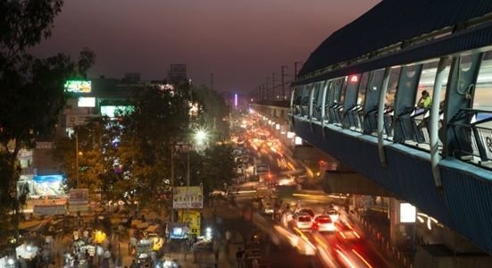
Connectivity here runs on two dedicated Blue Line stations — Uttam Nagar East and Uttam Nagar West — both operational since December 2005 and together handling tens of thousands of daily commuters. From either station, direct trains run toward Connaught Place, Pragati Maidan, and Vaishali or Noida City Centre, alongside easy interchange access toward Dwarka Sector 21 in the other direction. Numerous DTC bus routes serve both stations as well, extending reach into the sub-towns that sit further from the metro corridor itself.
What’s Nearby: Markets, Malls, and Everyday Essentials
Markets
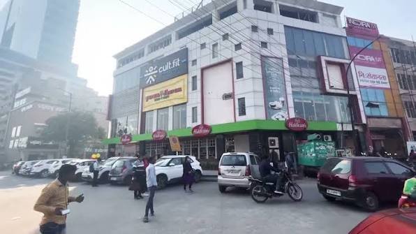
Gandhi Market and Shastri Market both serve Uttam Nagar’s shopping needs, covering everything from clothing to household essentials at prices generally more affordable than comparable South Delhi markets. Local shops throughout the various sub-towns handle daily groceries without residents needing to travel far.
Malls
Organised mall-style retail is limited within Uttam Nagar itself, and residents typically travel toward neighbouring Janakpuri or Dwarka for a full shopping-and-entertainment outing, since the locality’s own commercial character leans more toward open markets than enclosed retail.
Everyday Essentials
Chander Leela Hospital and B.M. Gupta Hospital serve as key healthcare facilities in and around the locality, backed by several smaller clinics scattered across the sub-towns. For education, Venkateshwara International School and Modern School are among the reputed institutions nearby, giving families reasonably good access to schooling without a long commute.
Frequently Asked Questions
Q1. Which of the two Uttam Nagar metro stations should I use — East or West?
It depends on which sub-town you’re in. Uttam Nagar East tends to serve residents closer to the Uttam Nagar Depot and Pankha Road side, while Uttam Nagar West is more convenient for those nearer Param Puri and the western stretch of Najafgarh Road. Check the specific gate exits against your address before assuming either is automatically closer.
Q2. Is Uttam Nagar a good option for someone commuting to Gurugram for work?
Yes, reasonably. The Blue Line’s direct connectivity, combined with the locality’s road access toward NH-44, makes Gurugram a manageable commute, though it’s still a longer daily trip than living closer to the Delhi-Haryana border itself.
Q3. How does housing affordability in Uttam Nagar compare to other West Delhi localities?
It generally runs more affordable than colonies like Rajouri Garden or Tilak Nagar, which is part of why the locality has seen such rapid population growth since the metro’s arrival. Buyers and renters looking for budget-friendly options with solid connectivity often find Uttam Nagar a practical middle ground.
Q4. What are the most common complaints residents have about living here?
Congestion and infrastructure strain come up frequently, largely a result of the locality’s fast population growth outpacing civic development in some sub-towns. It’s worth visiting the specific block or sub-town you’re considering at different times of day to get a realistic sense of traffic and crowding before committing.