Locals still call it “Bessie,” a nickname that’s stuck to Elliot’s Beach for generations, and the affection extends to the entire neighbourhood built around it. Besant Nagar has grown from a quiet coastal suburb into one of Chennai’s most sought-after addresses, drawing expatriates, senior professionals, and long-settled families alike who want sea air without sacrificing city convenience. Here’s a complete breakdown of where it sits, its pin code, transport options, and what surrounds it.
Besant Nagar Overview
| Detail | Information |
| Locality | Besant Nagar |
| City | Chennai |
| State | Tamil Nadu |
| Pin Code | 600090 |
| Known For | Elliot’s Beach, Ashtalakshmi Temple |
| Nearest Railway Station | Thiruvanmiyur (Chennai Suburban, approx. 4 km) |
| Nearest Metro Station | Teynampet / Nandanam (Blue Line, approx. 7 km) |
| Major Roads | Sardar Patel Road, East Coast Road, Arcot Road |
| Bordering Localities | Adyar, Thiruvanmiyur, Raja Annamalai Puram |
Location and Character
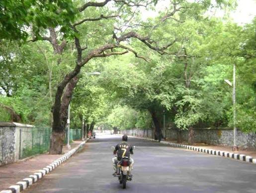
Besant Nagar sits along the Bay of Bengal in South Chennai, bordered by Adyar, Thiruvanmiyur, and the Raja Annamalai Puram area. Its coastal position, anchored by Edward Elliot’s Beach, has given the neighbourhood a genuinely upscale, laid-back seaside identity that’s rare within Chennai’s city limits. Landmarks like the Ashtalakshmi Temple and St. John’s English School sit alongside high-rise apartments, sea-facing villas, and a strong community of long-term residents, expats, and senior professionals who value the daily beach walks and relative tranquility this locality offers, even as it commands some of the city’s highest property rates.
Pin Code Details
Besant Nagar’s pin code is 600090, administered under the Rajaji Bhavan postal head office and covering the entire locality along with nearby pockets like Elliot’s Beach, Kalakshetra Colony, and the Theosophical Society area. The code is fairly well-defined and consistent across sources, making address confusion less of an issue here compared to some other Chennai localities, though it’s still worth pairing with a specific avenue or cross-street given how many residential blocks fall under the same code.
Getting Around: Metro, Roads, and Rail
Roads
Sardar Patel Road, the East Coast Road, and Arcot Road together form Besant Nagar’s core connectivity, linking the locality to T. Nagar in roughly 20 minutes and giving direct access toward the Rajiv Gandhi IT Expressway corridor. That road network puts major employment hubs like Ramanujan IT City and International Tech Park within about 5 km, and Perungudi, Saidapet, and Guindy within roughly 7 km, making Besant Nagar a genuinely practical base for professionals despite its coastal, residential feel.
Rail
Thiruvanmiyur Railway Station, part of the Chennai Suburban Railway network, is the nearest option at around 4 km, giving residents a reasonably close suburban rail link. Indira Nagar Railway Station adds a further nearby alternative for local rail travel.
Metro
Metro access requires a bit more travel from Besant Nagar itself. Sources place the nearest station variously at Teynampet or Nandanam, both on Chennai Metro’s Blue Line and roughly 7 km away — a distance too far to walk comfortably, meaning most residents combine an auto or cab ride with the metro for longer cross-city trips. Chennai International Airport, reachable via the Chennai-Trichy Highway, sits about 15 km out, translating to roughly 40 minutes by road.
What’s Nearby: Markets, Malls, and Everyday Essentials
Markets
Besant Nagar’s local markets cover groceries, organic food, and specialty items comfortably within walking distance for most residents, a genuine convenience that comes up repeatedly in resident feedback. The area’s compact, walkable layout means daily errands rarely require a vehicle.
Malls
Challa, Ramee, Welcome, and Bergamo malls all fall within a roughly 10 km radius, giving residents accessible options for a bigger shopping or entertainment trip without an extensive drive, even though none sit directly within the locality itself.
Everyday Essentials
Besant Gardens and the KCWA Badminton Court add recreational options beyond the beach itself, and MTC buses run frequently, connecting the locality to Adyar, Thiruvanmiyur, and Central Station. Auto rickshaws and cabs are readily available throughout the day. On the civic side, residents consistently praise the neighbourhood’s safety, water supply, and minimal power cuts, though street parking can get genuinely tight during holidays when Elliot’s Beach draws heavy crowds.
Frequently Asked Questions
Q1. Why do different sources list different nearest metro stations for Besant Nagar?
Distance and travel time estimates vary depending on the exact starting point within the locality and the specific route considered — some sources cite Teynampet, others Nandanam, both roughly 7 km away on the Blue Line. Either way, expect to combine road transport with the metro rather than walking directly to a station.
Q2. Is Besant Nagar too crowded to enjoy on weekends, given the beach’s popularity?
Elliot’s Beach does get genuinely crowded during evenings and holidays, which can dent the sense of tranquility residents otherwise enjoy. Weekday mornings or early evenings tend to offer a much quieter experience for anyone specifically seeking the peaceful coastal vibe.
Q3. How does Besant Nagar’s cost of living compare to other South Chennai localities?
It sits firmly at the premium end, with property rates averaging around Rs. 33,350 per sq ft for luxury apartments and sea-facing villas as of 2026, and rentals spanning a wide range from Rs. 7,000 to Rs. 1,00,000 depending on property type — generally higher than comparable inland South Chennai neighbourhoods without direct coastal access.
Q4. Is Besant Nagar a practical base for someone working in Chennai’s IT corridor?
Yes, reasonably. Ramanujan IT City and International Tech Park sit within about 5 km, and the Rajiv Gandhi IT Expressway provides a fairly direct route, making it a workable, if not the shortest, commute for professionals employed in that corridor.