Named after the revered 15th-century mystic poet Sant Kabir, this Uttar Pradesh district sits at the geographical midpoint between two significant eastern UP towns — Gorakhpur and Basti. Its headquarters, Khalilabad, traces its history back to the Mughal era, giving the district a genuine historical depth that belies its relatively young status as an administrative unit. Here’s a complete breakdown of where it sits, its pin code, transport options, and what surrounds it.
Sant Kabir Nagar Overview
| Detail | Information |
| District | Sant Kabir Nagar |
| State | Uttar Pradesh |
| Division | Basti |
| Headquarters | Khalilabad |
| Main Pin Code | 272175 (Khalilabad) |
| Tehsils | Khalilabad, Mehdawal, Ghanghata |
| Area | 1,646 sq. km |
| Population (2011) | 17,15,183 |
| Major Highway | National Highway 28 |
| Nearby Cities | Gorakhpur (36 km east), Basti (36 km west) |
Location and Character
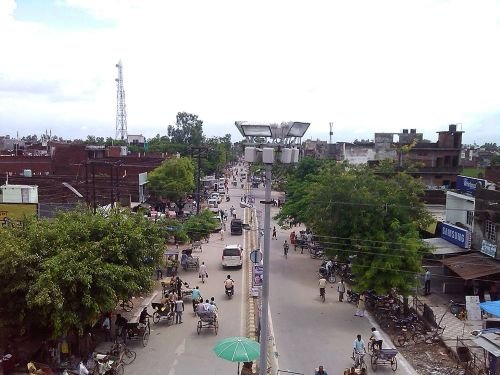
Sant Kabir Nagar district sits within the Basti division of Uttar Pradesh, with Khalilabad serving as its district headquarters and lying on the Ayodhya-Gorakhpur road, positioned almost exactly midway between Gorakhpur and Basti, each roughly 36 km away. The district itself is organised into three tehsils — Khalilabad, Mehdawal, and Ghanghata — and carries a genuine historical legacy: Khalilabad was established in June 1680, founded by Qazi Khalil-ur-Rahman, a representative of the Mughal emperor Aurangzeb in the region at that time. The district was formally identified by the Ministry of Panchayati Raj in 2007 as one of India’s 250 most backward districts, and continues receiving support through the Backward Regions Grant Fund Programme, reflecting the genuine developmental challenges alongside the district’s cultural and historical significance.
Pin Code Details
Sant Kabir Nagar district spans multiple pin codes across its three tehsils and various blocks. Khalilabad, the district headquarters, uses pin code 272175, which also covers the Baghuli and Nath Nagar blocks. Mehdawal tehsil carries a separate code, 272171, while Dhanghata (Ghanghata) uses 272162. Additional blocks like Haisar Bazar (272165) and Santha/Belhar Kala (272270) further illustrate how genuinely spread out the district’s postal coverage is. Given this real variation, it’s essential to confirm the specific tehsil or block pin code relevant to your address rather than assuming a single code covers the whole district.
Getting Around: Metro, Roads, and Rail
Roads
National Highway 28 is the district’s major highway, running through the region and connecting Khalilabad toward both Gorakhpur and Basti along the broader Ayodhya-Gorakhpur road corridor. This road network is the primary means of intercity travel for most residents, given the district’s largely rural and semi-urban character.
Rail
Khalilabad Railway Station, with station code KLD, sits on the Gorakhpur-Basti-Lucknow line, part of the Lucknow-Gonda-Gorakhpur main line under North Eastern Railway. The station features three well-sheltered platforms and a double electric line, giving Sant Kabir Nagar genuinely solid rail connectivity for a district of its size, linking it directly toward major eastern Uttar Pradesh destinations without requiring a long road trip first.
Metro
Sant Kabir Nagar district has no metro connectivity, consistent with its character as a predominantly rural and semi-urban district within the Basti division rather than a major urban centre.
What’s Nearby: Markets, Malls, and Everyday Essentials
Markets
Local markets throughout Khalilabad and the district’s various tehsils and blocks cover daily grocery, household, and general goods needs, reflecting the area’s practical, community-oriented commercial character rather than large-scale organised retail.
Malls
Organised mall-style shopping is genuinely limited within Sant Kabir Nagar district, consistent with its status as a smaller administrative district rather than a major urban hub. Residents wanting a fuller retail experience typically travel toward Gorakhpur, given its proximity and larger commercial infrastructure.
Everyday Essentials
The district is home to notable natural attractions, including the Bakhira Bird Sanctuary, a genuine draw for nature enthusiasts and a point of local pride for the district. Educational and healthcare facilities are concentrated primarily around Khalilabad and the other tehsil headquarters, given the district’s overall demographic spread and rural character.
Frequently Asked Questions
Q1. Why does Sant Kabir Nagar district have so many different pin codes?
The district covers three tehsils — Khalilabad, Mehdawal, and Ghanghata — each with their own distinct pin codes, plus additional codes for individual blocks like Haisar Bazar and Santha. It’s genuinely important to confirm the specific tehsil or block pin code for your exact location rather than assuming a single district-wide code.
Q2. How well-connected is Khalilabad by rail compared to other district headquarters in the region?
Reasonably well, given its position on the Gorakhpur-Basti-Lucknow line with a double electric line and three platforms at Khalilabad Railway Station, providing direct rail access toward major eastern Uttar Pradesh cities without needing to route through a larger hub first.
Q3. Is Sant Kabir Nagar a good area for someone interested in wildlife or nature tourism?
Yes, the Bakhira Bird Sanctuary within the district offers a genuine attraction for birdwatchers and nature enthusiasts, giving Sant Kabir Nagar a notable ecological point of interest beyond its administrative and historical significance.
Q4. What does being classified as a “most backward district” mean for residents today?
The 2007 classification by the Ministry of Panchayati Raj reflected developmental challenges at the time, and the district continues receiving support through the Backward Regions Grant Fund Programme, which channels additional resources toward infrastructure and development. It’s worth checking current, updated development indicators directly with district authorities for the most accurate present-day picture.